If you’re planning arizona to utah, the fastest way is to fly between Phoenix (PHX) and Salt Lake City (SLC), which is about 1.5–2 hours nonstop in the air plus airport time; if you’re road‑tripping, expect roughly 6.5–7.5 hours from Phoenix to Zion National Park and about 11–12 hours between Phoenix and Salt Lake City, with classic stops like the Grand Canyon, Page/Antelope Canyon, Bryce, and Monument Valley along the way.
Choose flying for point‑to‑point speed and driving for national‑park sightseeing, watch the Arizona–Utah time change from March to November (Arizona stays on Mountain Standard Time while Utah shifts to Daylight Time), and book permits early for high‑demand experiences such as Antelope Canyon guided tours or Angels Landing in Zion.
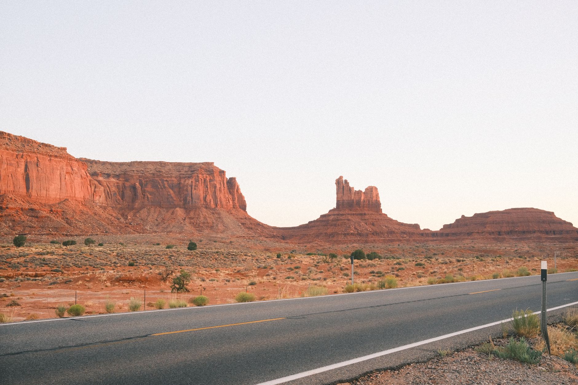
Quick answer: best ways to go from Arizona to Utah
Here’s a fast breakdown so you can decide in seconds and start reserving the pieces that actually sell out.
- Fastest overall: Fly PHX ↔ SLC. Nonstop flight time is typically 1.5–2 hours; door‑to‑door commonly lands around 4–5 hours including airport time and transfers.
- Best for sightseeing: Drive PHX → Zion in 6.5–7.5 hours (no major stops). PHX → SLC direct is 11–12 hours, but most travelers split it with one or two overnights at the Grand Canyon or Page.
- Primary highways: I‑17, I‑40, US‑89, UT‑9, I‑15. Fastest uses I‑17 → US‑89 → UT‑9 for Zion or continue to I‑15 for SLC.
- Classic stops: Grand Canyon South Rim or North Rim, Page (Horseshoe Bend and Antelope Canyon), Monument Valley, Zion, Bryce, Capitol Reef/Scenic Byway 12, Moab (Arches/Canyonlands).
Cost snapshot (very rough ranges):
- Drive your own car: Fuel for PHX↔Zion round‑trip in a mid‑size sedan might be $120–$180 depending on prices; add lodging, park fees, and parking. Families often save here.
- Fly + rent: PHX ↔ SLC tickets can run modest to high depending on season; add baggage fees and a rental car if you plan to tour Utah parks.
- One‑way rental: Efficient for “open‑jaw” routes (into PHX, out of SLC or vice versa), but watch for drop fees.
Time‑zone check: Arizona does not observe Daylight Saving Time (Navajo Nation does). Utah does. From March to early November, Utah runs one hour ahead of most of Arizona. This matters for tour times, shuttles, and sunrise/sunset planning.
Fastest vs scenic in one glance:
| Approach | Who it suits | Why |
|---|---|---|
| Fly PHX ↔ SLC | Point‑to‑point travelers, business trips, winter travel | Quickest door‑to‑door between metros; rent locally for Utah parks |
| Direct drive PHX → Zion/I‑15 | Weekend warriors, hikers with fixed permits | 6.5–7.5 hrs to Zion; beeline to the canyon and start hiking |
| Scenic PHX → Sedona → Grand Canyon → Page → Zion | First‑timers, photographers, families | Iconic Southwest highlights in one loop, flexible pacing |
Best routes from Arizona to Utah (fastest vs scenic)
Two frameworks work best: the fastest corridor for when you need to arrive the same day, and the scenic spine for when the journey is the point.
Fastest highway corridor
From Phoenix, head north on I‑17 to Flagstaff. Take US‑89 at Flagstaff toward Page, then UT‑9 to Springdale for Zion. For SLC, continue US‑89 to I‑15 north. This route minimizes slowdowns and stays on major highways for most of the distance.
- PHX → Zion (Springdale): ~410–430 miles; 6.5–7.5 hours with brief stops.
- PHX → SLC: ~660–690 miles; 11–12 hours with minimal stops.
- Road notes: I‑17 has long climbs and descents; expect potential construction and steep grades between Camp Verde and Flagstaff. US‑89 is fast but watch for wildlife, wind, and dark stretches at night. Winter can bring snow/ice around Flagstaff and high plateaus; carry patience and check conditions.
Most scenic spine
If you’re building a bucket‑list road trip, let US‑89 and UT‑12 be your backbone. This adds stops and stunning byways at the price of extra time.
- PHX → Sedona → Flagstaff → Grand Canyon South Rim → Page (Horseshoe Bend, Antelope Canyon) → Kanab → Zion → Bryce Canyon.
- With 6–7 days, extend to Capitol Reef via UT‑12 (Scenic Byway 12) and on to Moab for Arches and Canyonlands. Return via I‑70/I‑15 or fly out of SLC.
Key city‑pair drive times (no major stops):
| City pair | Miles | Typical time | Time‑zone note | Road notes |
|---|---|---|---|---|
| PHX → Page | 275–285 | 4.5–5 h | Same clock Nov–Mar; UT +1 hr Mar–Nov | I‑17, US‑89; services thin late at night |
| PHX → Zion (Springdale) | 410–430 | 6.5–7.5 h | UT +1 hr Mar–Nov | US‑89 → UT‑9 into Springdale |
| PHX → SLC | 660–690 | 11–12 h | UT +1 hr Mar–Nov | US‑89 → I‑15 north into SLC |
| SLC → Zion | 310–330 | 4.5–5 h | Same state time rules | I‑15 south most of the way |
| Flagstaff → Bryce Canyon | 275–290 | 4.5–5 h | UT +1 hr Mar–Nov | US‑89 → UT‑12; scenic, slower |
| Tucson → Zion | 520–540 | 8–9 h | UT +1 hr Mar–Nov | I‑10 → PHX → I‑17 → US‑89 |
Tip: Night driving on US‑89 and UT‑9 means long dark stretches and wildlife risk; if you can, arrive to Page or Kanab by dusk. For navigation and offline maps, see our guide to navigation tools and apps.
Top stops on the Arizona–Utah borderlands
Mix and match based on your time window, but budget enough time per stop to avoid a rushed blur.
- Grand Canyon South Rim: Classic viewpoints near Grand Canyon Village. Budget a half day to a full day. In high season, parking fills early; shuttle routes help.
- Grand Canyon North Rim: Shorter season and quieter, typically open mid‑May to mid‑October. Budget a half day to a day; roads and facilities close in winter.
- Page and Lake Powell: Horseshoe Bend requires a short walk on a sandy path; Antelope Canyon is guided‑only on Navajo land. Budget a half day for Horseshoe Bend plus 2–3 hours for a canyon tour.
- Monument Valley: Iconic sandstone buttes on Navajo land. Scenic drive and guided tours available. Budget a half to full day.
- Zion National Park: Narrow canyons and towering walls. Spring to fall, Zion Canyon uses a shuttle system for most trailheads; budget at least one full day.
- Bryce Canyon National Park: Hoodoo amphitheaters and high elevation. Short viewpoint loop can be done in a half day; trails merit a full day.
- Capitol Reef and Scenic Byway 12: Fruita orchards, Waterpocket Fold, and one of the most beautiful roads in the Southwest. Budget a day if detouring from Bryce to Torrey.
- Moab (Arches and Canyonlands): If you have a week, add 1–2 days for Moab’s red rock playground.
Permits and reservations that trip travelers up:
| Place/experience | Permit required? | How to book | Booking window | Guided‑only? | Seasonal notes |
|---|---|---|---|---|---|
| Antelope Canyon (Page) | Yes | Book with licensed Navajo tour operators | Weeks to months ahead in peak seasons | Yes | Midday light beams in Upper Antelope peak in late spring–summer |
| Angels Landing (Zion) | Yes | NPS seasonal/Day‑before lotteries | Seasonal lotteries months ahead; day‑before lottery | No | Chains can be icy in winter; shuttles in main season |
| The Wave (Coyote Buttes North) | Yes | Recreation.gov lottery | Advanced lottery months ahead; daily lottery near Kanab | No | Strict quotas; carry plenty of water |
| Arches timed entry | Sometimes | Recreation.gov timed entry (seasonal) | Opens months ahead | No | System not year‑round; check dates before you go |
| Zion shuttles | Indirectly | Included with park entrance | N/A | No | Shuttle seasons vary; private cars restricted in main canyon in season |
For a full Utah parks circuit, our Mighty 5 self‑drive itinerary has day‑by‑day routing, permit links, and pacing tips that pair well with an Arizona start.
How many days do you need? Sample 3–7 day plans
These sample itineraries assume a Phoenix arrival. Adjust nights based on flight schedules, lodging availability, and stamina. Consider an “open‑jaw” plan (into PHX, out of SLC or LAS) to save backtracking.
3 days: Phoenix → Grand Canyon → Page → Zion
- Day 1: PHX → Grand Canyon South Rim via I‑17 and AZ‑64. Sunset viewpoints.
- Day 2: Grand Canyon → Page. Morning rim strolls, then Horseshoe Bend in late afternoon. Optional Antelope Canyon tour if you can nab a slot.
- Day 3: Page → Zion via US‑89 and UT‑9; short hikes in Zion. Fly out of St. George (SGU), LAS, or return to PHX next day.
5 days: Phoenix → Sedona → Grand Canyon → Page → Zion → Bryce
- Day 1: PHX → Sedona for red rock views and a short hike.
- Day 2: Sedona → Grand Canyon South Rim.
- Day 3: Grand Canyon → Page (Horseshoe Bend and Antelope Canyon).
- Day 4: Page → Zion; explore lower‑effort trails or Canyon Overlook.
- Day 5: Zion → Bryce Canyon; drive the viewpoints. Fly out of LAS/SGU or loop back via Kanab and Page to PHX.
7 days: Add Capitol Reef or Moab
- Day 1: PHX → Sedona.
- Day 2: Sedona → Grand Canyon South Rim.
- Day 3: Grand Canyon → Page.
- Day 4: Page → Zion.
- Day 5: Zion → Bryce → UT‑12 to Torrey (Capitol Reef).
- Day 6: Capitol Reef → Moab for Arches.
- Day 7: Arches/Canyonlands → drive to SLC and fly home, or return south.
Prefer to focus on one state? Save Arizona for a shorter loop and dedicate a future week to Utah’s national parks using our Mighty 5 guide and these scenic‑drive tips.
Costs and logistics: drive vs fly vs one‑way rental
There isn’t a single cheapest option because costs vary by season, group size, vehicle type, and how many parks you add. Use the matrix below as a planning tool, then price your specific dates.
| Mode | Door‑to‑door time | Est. total cost per person (range) | Pros | Cons | Notes |
|---|---|---|---|---|---|
| Drive round‑trip | PHX → Zion ~7 h each way | Lower for 3–4 people; fuel split | Flexibility, easy to carry gear | Long days, parking competition | Consider America the Beautiful pass for park entries |
| Fly PHX ↔ SLC + rent | ~4–5 h door‑to‑door to SLC | Tickets vary; add baggage + rental | Fast between cities; winter friendly | Rental queues, weather delays possible | Check carry‑on sizes and baggage fees |
| One‑way rental | Eliminates backtracking | Efficient for pairs; watch drop fees | Saves time, linear route | Drop fees can be significant | Search different pickup/return combos |
Airports that work well: PHX for Arizona; SLC for northern Utah; SGU (St. George) for Zion/Bryce with limited service; LAS is a popular gateway for Zion/Bryce as well. If your plan involves several parks after arriving in Utah, you may be better off flying to SLC and renting there.
To reduce backtracking, try “open‑jaw” tickets (into PHX, out of SLC or vice versa). You can combine this with a one‑way car rental to run PHX → Zion → Bryce → SLC efficiently. For airfare techniques, see our cheap flights strategies and, if you fly frequently, our loyalty program guide.
Parking and shuttles: Zion Canyon requires shuttles most of the main season; Springdale parking fills early. In Bryce, lots can fill at Bryce Point and Inspiration Point by late morning. Arrive early or plan late‑day visits when light is gorgeous and crowds thin.
Vehicle choice: A standard car works for paved park highlights. If you’re tempted by back roads, know the difference between high‑clearance and true 4×4 routes. Many trips don’t need an SUV, and fuel costs are lower in a sedan. If you do want the comfort of an SUV, our brief primer on choosing the right vehicle can help you decide.
Timing, weather, and seasonal closures
Spring and fall are prime for hiking across this region: mild temperatures and manageable crowds. Summer brings heat (especially in the desert and lower canyons) and afternoon thunderstorms during the monsoon period (generally July–September). Winter can be magical at higher elevations but adds snow and ice risk.
- Grand Canyon North Rim typically closes in winter (roads and services). The South Rim is open year‑round.
- Zion and Bryce sit at different elevations: Zion Canyon floor can be warm well into fall, while Bryce’s rim is around 8,000 feet and far colder; snow is common in winter.
- Arches has used seasonal timed entry; check the current schedule. Zion relies on shuttles in peak periods. Plan around these systems so you aren’t surprised at the gate.
- Wildfire smoke can occasionally affect visibility; check conditions before sunrise photography plans.
Shoulder seasons win for most travelers: late April–May and mid‑September–October balance pleasant weather with decent availability. Book early for weekends and holidays.
Practical tips for a smooth arizona to utah trip
Time‑zone math
Arizona stays on Mountain Standard Time year‑round except in the Navajo Nation, which follows Daylight Saving Time. Utah shifts to Mountain Daylight Time from March to early November. That means in summer your 7:00 am Page tour is 8:00 am in nearby Utah. Double‑check time stamps on tour confirmations and shuttle schedules.
Fuel and EV charging plan
Don’t assume 24/7 services in rural stretches. Top up when you can. Here’s a simple planning sheet to reduce range anxiety.
| Segment | Last reliable fuel/charge | Next reliable stop | Distance | After‑hours options | Notes |
|---|---|---|---|---|---|
| Flagstaff → Page (US‑89) | Flagstaff | Page | 135–140 mi | Limited overnight stations; check hours | Windy, exposed; monitor range |
| Page → Kanab | Page | Kanab | 75–80 mi | Sparse late night services | Beautiful but remote stretch |
| Kanab → Zion (Springdale) | Kanab | Springdale | 40–45 mi | Some early closure times | UT‑9 climbs; regen can help EVs downhill |
| St. George → Bryce (via US‑89 → UT‑12) | St. George/Cedar City | Hatch/Panguitch | 140–160 mi | Plan daytime arrivals | High elevation; winter closures possible |
EV specifics: Flagstaff, Page, Kanab, St. George, Cedar City, and Springdale have growing networks of Level 2 and some DC fast chargers; gaps still exist between Page and Kanab and along UT‑12. Use apps to verify status before committing. Charge to a comfortable buffer before leaving major towns.
Permits and booking windows
Permits and tour slots are the number one trip‑breaker. Set calendar reminders and know refundable windows.
- Antelope Canyon: Book directly with licensed guides. Popular mid‑day photo slots are scarce months ahead.
- Angels Landing: Apply in the seasonal or day‑before lottery. If you don’t secure it, Zion still has fantastic hikes like Observation Point (via East Mesa) and the Watchman Trail.
- The Wave: Treat it as a bonus; build a great trip without it, then enter the lottery on the side.
- Arches timed entry: If active, plan your day around your time window and arrive with buffer.
Packing for deserts and high country
- Layers: Zion canyon floor and Bryce rim can differ by 20–30°F in the same day.
- Sun protection: Hat, UPF shirt, sunglasses, sunscreen, and lip balm.
- Water capacity: Hydration packs or large bottles; carry more than you think you’ll need.
- Footwear: Grippy trail shoes for slickrock; closed‑toe for sandy canyon walks.
- Lights: A small headlamp helps for dawn/dusk parking and photo stops.
- Navigation: Download offline maps; paper maps are handy too. This is where our navigation tool guide shines.
Common planning mistakes and who this trip is not for
- Overscheduling: Two parks in one day sounds efficient but costs you the light and calm you came for. Give yourself margin.
- Dirt‑road detours: Don’t commit to remote tracks without high‑clearance experience, proper tires, and a weather check. Many highlights are accessible on pavement.
- Ignoring time‑zone differences: Summer itineraries slip when your 9:00 am Utah tour is 8:00 am in Arizona. Set your phone’s time zone manually if it keeps switching.
- Underestimating heat: Aim hikes for early morning or late day in summer; save viewpoints and scenic drives for midday.
Answers to common questions
- Can you do a day trip from Phoenix to the Grand Canyon? Yes. It’s 3.5–4.5 hours to the South Rim each way. Many travelers make a long day of it with sunrise or sunset on the rim.
- How long is a flight from Arizona to Utah? Nonstop PHX ↔ SLC is about 1.5–2 hours in the air, often 4–5 hours door‑to‑door including airport time.
- Is Utah next to Arizona? Yes. They share a long border along Arizona’s northern edge; key crossings sit near Page/Kanab and Monument Valley.
- What is the fastest route from Phoenix to Zion? I‑17 → US‑89 → UT‑9 through the east gate of Zion; typical 6.5–7.5 hours.
- Do I need a guided tour or permit for Antelope Canyon or The Wave? Antelope Canyon requires a guided tour. The Wave requires winning a lottery permit.
If you love long drives as much as the destination, you might enjoy our broader advice on exploring scenic drives and even branching into other routes like the Pacific Coast Highway for a future trip.
Finally, if you’re still deciding between flying and driving, compare your calendar, permit odds, and budget. Flyers with limited time can connect in SLC and rent for a focused Utah loop, while road‑trippers can build a highlight reel from Sedona to Zion in a handful of days. Either way, a bit of planning locks in the best daylight hours and the experiences you care about most.