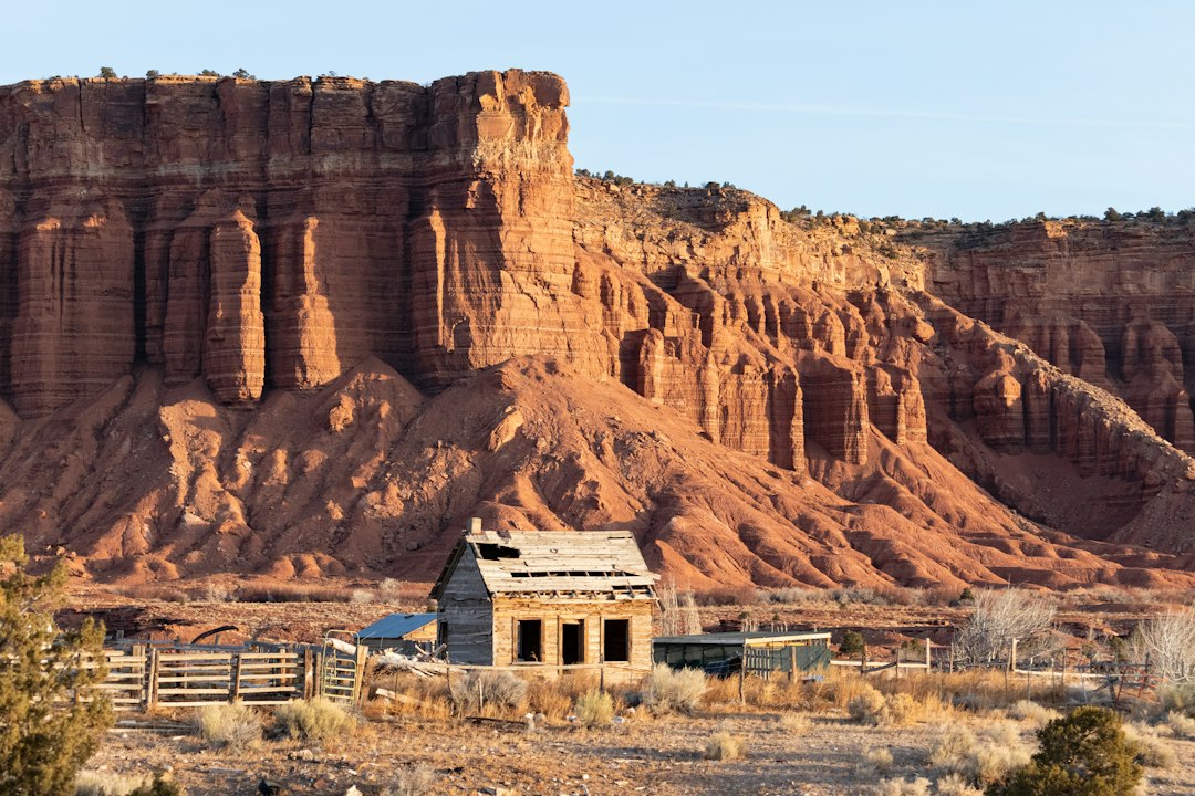
If you’re looking for abandoned places in utah, the state has dozens of ghost towns and ruins you can visit legally, including Grafton, Silver Reef, Frisco, Sego Canyon, and viewpoints of Thistle and the Tintic Standard Reduction Mill.
Use our map and itineraries to reach them from Salt Lake City, Moab, or Zion, expect little to no entry fees, and always follow posted signs—urban “abandoned” buildings in city limits are typically off-limits. Below you’ll find where to go, how to access each site, the best seasons, and a side-by-side table so you can pick a route that fits your time, vehicle, and comfort level.
Quick answer: the best abandoned places you can visit (legally)
Here are the quick picks, plus what makes each one worth your time:
- Grafton Ghost Town (near Zion): Preserved townsite with restored buildings, a photogenic cemetery, and classic red-rock backdrops.
- Silver Reef (Leeds): Museum-managed silver boomtown with ruins, foundations, and interpretive signs; small museum fee supports upkeep.
- Frisco Charcoal Kilns (near Milford): Dramatic beehive kilns on BLM land with towering mountain horizons.
- Sego Canyon (near Moab/Thompson Springs): Old townsite remnants plus famed rock art panels along the canyon walls.
- Tintic Standard Reduction Mill (Utah County): Colorful concrete smelter ruins are viewpoints only from public pullouts; the interior is closed and posted.
- Thistle (US-6 south of Spanish Fork): Landslide ghost town visible from highway pullouts; do not enter private property.
Who this is for: Travelers who enjoy outdoor ruins, ghost town history, and legal roadside viewpoints. Families will appreciate Grafton, Silver Reef, Old Irontown, and Sego Canyon for easy access and learning value. Explorers with high-clearance vehicles may add rougher West Desert stops like Frisco. If you’re after urban exploration inside city buildings, that’s largely off-limits; choose these legal alternatives instead.
Cost/time snapshot: Most sites are free or donation-based; museum stops are typically under $10. Expect 30–120 minutes at each stop, more if you’re photographing or reading interpretive signs.
Season tips: Spring and fall bring mild temperatures and great light. Summer heat is intense and monsoon storms can wash out dirt roads. Winter can be quiet and beautiful, but days are short and some roads may be slick.
Common mistakes to avoid: Trespassing at posted sites, entering mine adits or shafts, climbing on structures, underestimating desert heat or cold, and forgetting extra water and a spare tire.
Abandoned places in utah by region: where to go and what you’ll see
Northern Wasatch/Provo corridor
Tintic Standard Reduction Mill: The photogenic, terraced concrete ruins of the early 1900s smelter sit just off US-6 between Santaquin and Goshen. The structure itself is closed to the public and posted; enjoy it from designated roadside pullouts and signed viewpoints. Bring a mid-telephoto lens to compress the terraces against distant hills. Best light is late afternoon. Two-wheel-drive access on pavement.
Eureka: A semi-abandoned mining town with a small museum presence and lived-in neighborhoods. Stroll Main Street for storefronts and period signs, but respect private property. Pair this with a drive-by of the Tintic Mill for a full half-day loop from the Provo area.
Thistle: In 1983, a massive landslide dammed the river and destroyed the town. You can see remaining foundations and waterlines from highway pullouts on US-6. Everything you’re looking at is on or surrounded by private land; stay at the pullouts for photos and context.
Southern Utah (Zion/Cedar area)
Grafton Ghost Town: One of Utah’s most photogenic ghost towns, framed by Zion’s cliffs. Several buildings are restored, with interpretive panels and a historic cemetery a short drive away. It’s a self-guided, donation-supported site; check the onsite signage for any seasonal closures. The dirt road is usually fine for standard cars in dry weather.
Silver Reef (Leeds): A sandstone-hosted silver rush boomtown turned museum-managed site. Expect foundations, a reconstructed main street segment, and good signage. The small museum, when open, offers context and exhibits; fees are modest and help maintain the site.
Old Irontown (west of Cedar City): Short, easy trails lead to ironworks ruins and kilns with interpretive signs. Great picnic stop, generally accessible to standard vehicles. Late afternoon warms the stone with golden light.
Eastern Utah (Moab/Grand County)
Sego Canyon (near Thompson Springs): A two-for-one stop combining ghost town remnants and renowned rock art panels. Drive the graded road past the art panels to reach scattered foundations and the old cemetery; high-clearance is helpful beyond the initial panels if the road is rutted. Do not touch or chalk rock art, and keep a respectful distance with cameras.
Cisco: A former railroad and oil stop off I-70 that now blends relic structures with a small creative community. Some parcels are private and active; photograph from public roads, and do not enter buildings. Morning or evening light suits the wide, open scenery.
West Desert (farther and wilder)
Frisco Charcoal Kilns (near Milford): Striking beehive kilns remain from one of Utah’s boom-and-bust mining districts. The main access is on BLM land via graded dirt; high-clearance can be helpful if it’s washboarded or after storms. Do not enter or climb on any structure.
Iosepa Cemetery and Monument (Skull Valley): A solemn and well-marked site dedicated to the Polynesian community that settled the area in the late 1800s. It’s a short stop along a paved road; be respectful and avoid any activities that would disrupt the site’s quiet character.
How to visit legally and safely
Access status, decoded:
- Public land (BLM/State): Generally open to dispersed recreation, but specific ruins can be fenced or signed. Follow site-specific rules.
- Museum-managed/heritage sites: Self-guided during daylight hours; some have donation boxes or small entry fees. Buildings may be stabilized but still fragile.
- Private property: Only view from public roads or signed pullouts. If a site is posted or fenced, do not cross. When in doubt, skip it.
Read and respect signs: “No Trespassing,” “Area Closed,” and “Private Road” signs mean exactly that. Fences and gates are not photo props. Many hazards aren’t obvious until you’re right on top of them, which is one more reason to stay outside posted boundaries.
Safety basics:
- Stay out of mines and shafts. Openings can be oxygen-poor with unstable edges.
- Avoid unstable floors, roofs, and walls. Even “restored” buildings can have weak points.
- Watch for open pits, cactus, snakes, and old nails or glass. Wear sturdy closed-toe footwear.
- Bring more water than you think you need, sun protection, snacks, and layers.
- Download offline maps and tell someone your route and ETA.
Urban-sites note: City buildings that look abandoned are often patrolled or actively owned. That’s not the experience this guide covers. If you like history without boundary worries, choose places like Grafton, Silver Reef, Old Irontown, Sego Canyon, and signed roadside viewpoints.
Etiquette and preservation: Pack out all trash, keep vehicles on established roads, don’t remove artifacts, and leave rock art exactly as you found it. Your restraint helps keep these places open.
Mini itineraries from major hubs (drive times + mileage)
Use these day plans as frameworks; add photo stops and meals to taste. For park-heavy trips that combine ruins with scenic drives, see our Utah Mighty 5 self-drive itinerary.
- From Salt Lake City/Provo (1-day, ~210 miles, 5–6 hours driving): SLC → Tintic Standard Reduction Mill viewpoints → Eureka Main Street → Thistle pullouts → return via Spanish Fork Canyon. Paved roads; easy for any car. If you have extra time, add a short walk at Utah Lake State Park for sunset.
- From Zion/Southern Utah (1-day, ~160 miles, 4–5 hours driving): Springdale → Grafton townsite and cemetery → Silver Reef ruins and museum in Leeds → Old Irontown near Cedar City → back to Zion area. Mostly paved; short, well-graded dirt near Grafton.
- From Moab/Grand County (1-day, ~120 miles, 3–4 hours driving): Moab → Sego Canyon rock art and townsite → Cisco roadside relics → back to Moab for golden-hour river views. Check road conditions if recent rain has hit Sego Canyon.
- Long weekend, West Desert loop (mix of paved/gravel): SLC → Iosepa monument → Delta (fuel/food) → Milford → Frisco kilns → overnight in Cedar City or Beaver → Eureka → back to SLC. Plan fuel stops ahead and carry an emergency water stash. Expect spotty cell service.
Photographing Utah’s ruins without causing damage
Light and timing: Golden hour makes textures pop and softens harsh desert contrast. Midday is useful for scouting but creates hard shadows. In summer, start early to beat the heat.
Lens and gear ideas: A wide lens captures townscapes and the relationship between buildings and landscape, while a mid-telephoto isolates details like kiln bricks, metalwork, and signage. A travel tripod helps at dawn/dusk. Protect gear with a simple dust cover or zip bag.
Drones: Check local rules before launching. Avoid flying over people, livestock, or wildlife. Museum-managed sites and heritage townsites may restrict launching/landing on their property. Near national parks, mind the boundaries where aircraft rules apply.
Compositions that tell a story: Include interpretive signs, distant mine tailings, or cemetery rows to anchor your frame in history. Keep distance from fragile structures; you can suggest proximity by using longer focal lengths rather than walking close to unstable walls.
Planning tools: interactive map + site comparison table
Plan with three steps: pick legal sites, confirm vehicle needs and season, then download offline maps for your route. We like layering a saved map with pins for region and access type. For road-trip idea generation, this site’s Roadside Attractions guide pairs nicely with the ghost towns below.
Note: Parking coordinates are approximate and rounded; verify on official maps or posted signage at the site.
| Site | Region/Hub | Parking GPS (approx.) | Access status | Fee/Permit | Vehicle needs | Walk distance/terrain | Typical time | Hazards noted | Photo highlights | Nearby services | Cell coverage |
|---|---|---|---|---|---|---|---|---|---|---|---|
| Grafton | Zion/Springdale | 37.16, -113.05 | Managed heritage site | Donation box | 2WD, short graded dirt | 0.2–0.6 mi easy | 45–90 min | Heat, snakes, fragile floors | Restored buildings, cemetery, red cliffs | Springdale | Spotty |
| Silver Reef | Leeds/St. George | 37.24, -113.36 | Museum-managed ruins | Museum fee (when open) | 2WD pavement | 0.1–0.4 mi easy | 45–90 min | Heat, uneven ground | Foundations, signage, museum exhibits | Leeds/Hurricane | Good |
| Frisco Kilns | Milford/Beaver | 38.45, -113.32 | Public (BLM) | Free | 2WD OK, high-clearance helpful after storms | 0.1–0.3 mi easy | 30–60 min | Winds, loose rock | Beehive kilns, big skies | Milford | Spotty |
| Sego Canyon | Moab/Thompson | 39.05, -109.71 | Public (BLM) | Free | 2WD to panels; high-clearance beyond if rutted | 0.1–1.0 mi easy/moderate | 60–120 min | Do not touch rock art; heat | Rock art, cemetery, cabins | Thompson Springs | Spotty |
| Tintic Standard Reduction Mill | Utah County | 39.95, -111.90 | Private-view only (roadside) | Free | 2WD pavement | View from signed pullouts | 15–30 min | Traffic near US-6; steep slopes | Terraced concrete ruins | Santaquin/Genola | Good |
| Thistle (pullouts) | US-6 south of Spanish Fork | 39.97, -111.46 | Private-view only (roadside) | Free | 2WD pavement | Short pullout walks | 15–30 min | Traffic; no shoulder in places | Landslide valley, remnants | Spanish Fork | Good |
| Old Irontown | Cedar City area | 37.62, -113.24 | Public (signed site) | Free | 2WD pavement/gravel | 0.3–0.8 mi easy | 30–60 min | Loose stone, heat | Kilns, ironworks ruins | Cedar City | Spotty |
| Cisco | Between Moab and Grand Junction | 38.97, -109.33 | Mixed; active private parcels | Free (roadside) | 2WD pavement | Roadside viewing | 20–40 min | Private property, splinters | Rail-era relics, wide-open desert | Fruita/Green River | Spotty |
| Eureka | West of Provo | 39.95, -112.13 | Active town with historic core | Free; museum donations welcome | 2WD pavement | Town strolls | 30–90 min | Traffic; respect residents | Main Street facades, signage | Onsite | Good |
| Iosepa Monument | Skull Valley | 40.34, -112.72 | Monument and cemetery | Free | 2WD pavement | Short walks | 15–30 min | Respectful behavior required | Monument, headstones, mountain backdrop | Tooele/Grantsville | Spotty |
Desert day-trip checklist
- Water: at least 3–4 liters per person (more in summer)
- Wide-brim hat, sunscreen, sunglasses
- Closed-toe hiking shoes
- Offline maps and a paper backup or printed notes
- Charged phone, power bank, and a basic first-aid kit
- Spare tire, jack, tire repair kit, and a way to air up
- Snacks or lunch; there may be no services on route
- Warm layer even on hot days (desert nights can cool quickly)
- Respect posted signs and fences
- Stay out of mines and closed buildings; pack out all trash
FAQs
Is it illegal to explore abandoned places in Utah?
It depends on the site. Many ghost towns, kilns, and roadside ruins sit on public land or are museum-managed and welcome respectful visitors. Trespassing onto posted private property is illegal, and entering closed structures or mines is unsafe. Stick to places listed here, follow signs, and view posted or fenced sites from designated pullouts.
What ghost towns are near Salt Lake City or Provo?
Within a day trip you can see the Tintic Standard Reduction Mill from the road, explore Eureka’s historic main street, and stop at the Thistle pullouts on US-6. Add Iosepa in Skull Valley for a different side of Utah history. All are reachable on paved roads.
Can you visit Grafton Ghost Town and Silver Reef on your own?
Yes. Grafton is self-guided with on-site signs and a donation box; the road is typically passable for standard cars in dry weather. Silver Reef has ruins you can walk among and a small museum that’s open on a posted schedule. Check hours for the museum if you want the exhibits as part of your visit.
Where can I find an “abandoned places in Utah” map?
Use the comparison table above to shortlist sites, then build a custom Google Map with pins. Download offline maps for your phone ahead of time. Many travelers also keep a paper atlas or take screenshots in case signal drops. For broader road-trip planning ideas across Utah, see our Attractions and Activities guide on this site.
What is the best season to visit Utah ghost towns?
Spring and fall offer mild temperatures and reliable road conditions. Summer is possible but hot and stormy, so start early and bring more water than you think you need. Winter is peaceful with low sun angles that photograph well, though days are short and shaded roads can be icy.
Is the Tintic Standard Reduction Mill open to the public?
No. The terraced structure is closed to entry and posted. You may view and photograph it from public pullouts along US-6. Do not cross fences or climb on the structure.
With the right expectations and preparations, Utah’s ghost towns and ruins are a rewarding add-on to national park itineraries or an entire trip of their own. Pick legal sites, plan for desert conditions, and take only photos—these places will continue to tell their stories for the next curious traveler.