If you’re dreaming about mountain passes, old-growth rainforests, lighthouse-dotted headlands, and a swirl of coffee, craft beer, and small-town diners, a Pacific Northwest self-drive itinerary delivers all of that in one loop. This guide lays out practical 7–14 day routes through Washington and Oregon, with mileage, time estimates, car prep and packing checklists, budgets, seasonal notes, and local tips you can use right away.
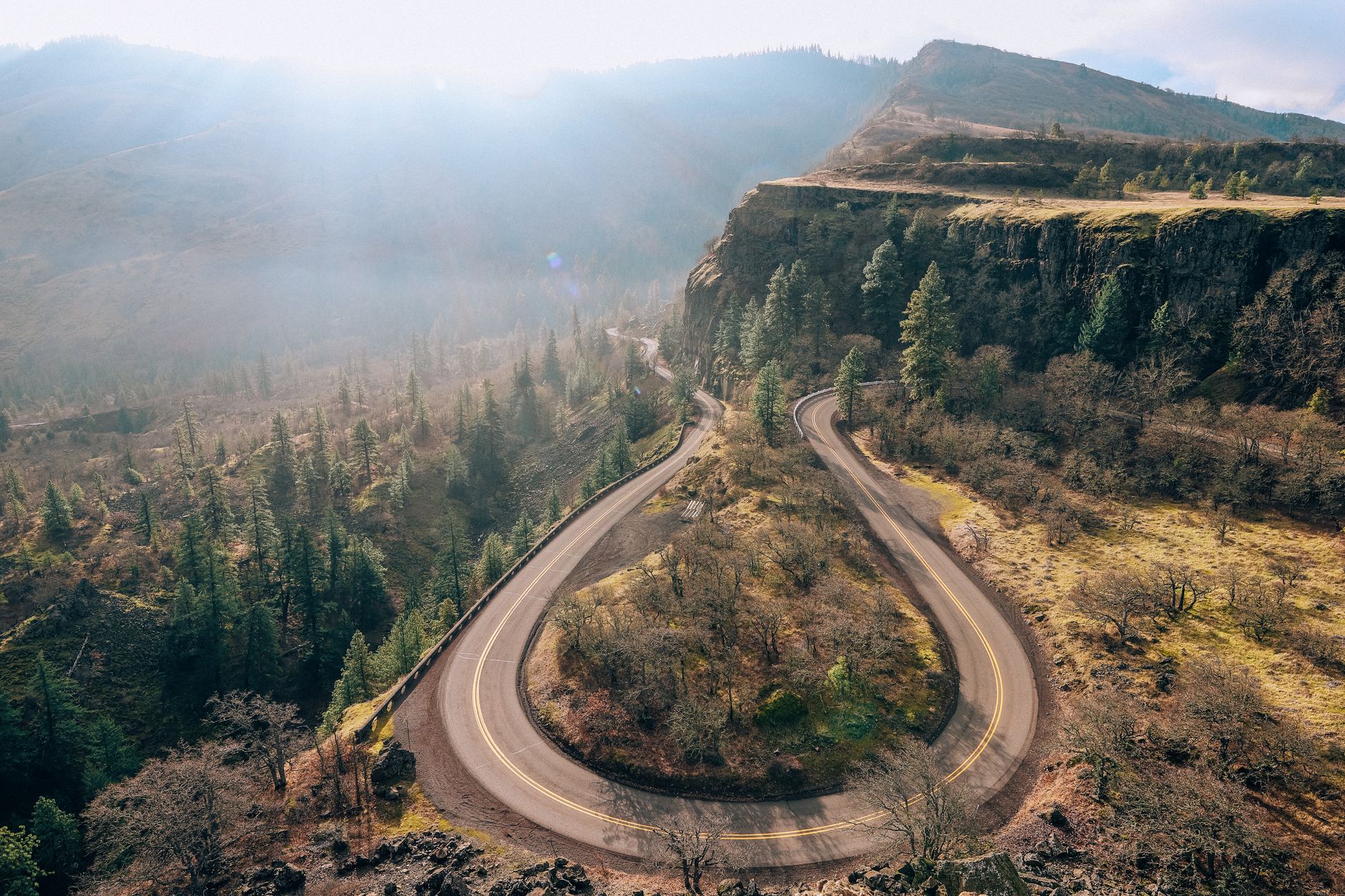
Pacific Northwest self-drive itinerary at a glance
This region rewards slow travel. Distances look short on a map, but twisty coastal highways, mountain passes, and irresistible viewpoints make days fuller than you might expect. Think in clusters: the Olympic Peninsula and Washington coast; Seattle and the Cascades; the Columbia River Gorge and Mount Hood; the Oregon coast; Bend and the high desert; Crater Lake and the Southern Cascades; and the Willamette Valley for food and wine. Stringing two or three clusters together makes a great week; four to six clusters fill a relaxed two weeks.
Most visitors fly into Seattle (SEA) or Portland (PDX). From there, common patterns include:
- Fly-and-drive loops that return to your arrival city
- One-way routes between SEA and PDX (price the drop fee before committing)
- RV or campervan circuits using public and private campgrounds
Navigation is straightforward. On the coast, US‑101 circumnavigates bays and headlands; inland, I‑5 is the north–south spine and I‑84 runs the Columbia River Gorge. Expect rain-slick pavement any month, foggy mornings on the ocean, summer paving projects, and the occasional rockfall zone in the Cascades. Cell service drops on forested stretches and along headlands; download offline maps and save key trailheads and grocery stops. Carry small bills for a few rural bridge tolls and day-use parking machines that don’t take cards.
Highlights to plan around include:
- Coast: Rialto and Ruby Beach (WA), Cannon Beach and Cape Kiwanda (OR), Yaquina and Heceta Head lighthouses
- Mountains: Hurricane Ridge, Mount Rainier viewpoints, Mount Hood’s Timberline, Cascade Lakes Scenic Byway near Bend
- Waterfalls: Multnomah, Latourell, Wahclella, Salt Creek
- National parks: Olympic (WA) and Crater Lake (OR)
- Town bases: Port Angeles, Astoria, Cannon Beach/Manzanita, Portland, Hood River, Bend, Eugene, and Ashland (add-on)
When to go and how to pace your days
There isn’t a single best season. Each window brings a different mood and packing list. Here’s a calendar read plus pacing ideas that keep driving time comfortable.
- May–June: Spring wildflowers, full waterfalls, lingering chilly passes. Expect mixed sun and showers. Roads are open but some high trails still hold snow. Crowds are moderate and lodging prices are more flexible than midsummer. It’s a good time for a first loop if you like green landscapes and milder costs.
- July–August: Dry trails, warm coast, long daylight, lively small towns. Lodging books up early. On hot spells, interior valleys and Bend can reach the 90s°F. If regional smoke lowers visibility, consider coastal detours and start hikes early to catch clearer mornings. Lake days and short waterfall walks keep the pace easy when the thermometer climbs.
- September–mid‑October: Many locals’ favorite. Crisp mornings, golden larches at higher elevations later in the season, harvest in the Willamette, calmer beaches. Days are shorter but still generous. Pack for big temperature swings; a 40°F morning can become a 70°F afternoon. Restaurant lines shrink and scenic pullouts feel quieter.
- Late October–April: Storm watching on the coast, snowy Sno‑Parks, solitude in national forests, and excellent city time. Some mountain roads require traction devices. Campground services scale back; check access conditions and office hours at smaller museums and cafés before committing to remote routes. A winter city‑and‑coast loop can be a great value.
Daily rhythm tips:
- Aim for 2–4 hours of wheel time with a long stop midday and a late‑afternoon leg to your overnight. On coastal days dotted with overlooks and tide pools, 120 miles can feel full.
- In the interior, 200–250 miles is comfortable if you stick to highways and keep stops brisk. Add slack for scenic byways and dirt spurs to trailheads.
- Fuel plan: top up when you dip below half a tank in rural stretches. On the Oregon coast and in parts of the Peninsula, stations can be spaced out or close early off‑season.
- Food plan: keep a cooler with drinks, fruit, and picnic fixings so you can catch light windows and not race mealtimes.
The 10‑day loop: Seattle, Olympic, Oregon Coast, Portland, Gorge, Bend, Crater Lake
This sample loop keeps daily drives reasonable and stacks landscapes in a way that feels natural: ocean to cities to volcanoes to forests. Use it as a base and swap days or extend overnights to match your pace. Mileage and timing below assume no long detours; if a viewpoint or trail calls your name, lean into it and trim later stops.
Day 1: Arrive Seattle → Port Angeles (140 miles)
Pick up the car and roll straight onto the Edmonds–Kingston or Bainbridge ferry for a scenic crossing. Expect the terminal process to take longer than a simple highway merge in peak hours; arriving 30–45 minutes ahead reduces stress. Continue to Port Angeles. If time allows, drive up to Hurricane Ridge for golden-hour ridgelines (check the live status; hours and access vary). Dinner in town; sleep in Port Angeles. If you arrive late, leave the ridge for the morning and walk the Port Angeles Waterfront Trail for a stretch.
Time and tips: 3–4 hours total with the ferry. Ferry cafés carry hot drinks for breezy decks. Keep a warm layer handy even in July.
Day 2: Olympic National Park beaches and rainforest (80–120 miles)
Option one: West to Lake Crescent for a lakeshore walk or the Marymere Falls trail. Then continue to Rialto or Ruby Beach for sea stacks and tide pools. Option two: South to the Hoh Rain Forest for the Hall of Mosses loop, then end around Forks or La Push lodging. Keep an eye on the tide chart if you plan arch walks or sea‑stack scrambles.
Accessibility notes: Lake Crescent has several flat lakeside segments. Ruby Beach has a steep, gravelly access path; trekking poles help. The Hoh Hall of Mosses loop is mostly gentle.
Day 3: Washington coast → Astoria (150–180 miles)
Follow US‑101 past bays, spruce, and fishing towns. When conditions allow, add a quick walk at Beach 4 or Kalaloch. Stop at Cape Disappointment near the mouth of the Columbia for lighthouse views and interpretive centers. Cross the Astoria‑Megler Bridge and wander Astoria’s riverfront boardwalk. Overnight in Astoria; if you like history, plan the Columbia River Maritime Museum for an hour or two.
Small detail that helps: Cape Disappointment and the Bridge of the Gods both collect small tolls or fees; bring a card or a few dollars just in case a machine is down.
Day 4: Astoria → Cannon Beach/Manzanita (25–45 miles)
Short mileage, big scenery. Ecola State Park offers classic overlooks and short trails through spruce to ocean views. Walk the tide line at Cannon Beach beneath Haystack Rock, then head to Manzanita for quieter sands. If you want a hike, the Neahkahnie Mountain viewpoint trail delivers broad coastal views. Sunset on the sand; stay in Cannon Beach or Manzanita.
Rain plan: Explore Cannon Beach galleries and cafés, or duck into the small but engaging local history museum before a clearing window.
Day 5: Cannon Beach → Tillamook → Cape Kiwanda → Pacific City/Lincoln City (65–95 miles)
Drive the Three Capes Scenic Loop when open. Visit Cape Meares lighthouse and the “Octopus Tree,” a giant Sitka spruce. In Tillamook, swing by the Creamery visitor center for ice cream or cheeses and grab picnic supplies. End at Cape Kiwanda for dunes and dory boats powering through surf. Overnight in Pacific City or Lincoln City. If wind picks up, a windbreaker and eye protection make the headland stroll more pleasant.
Day 6: Coast → Portland (100–120 miles)
Option A: Head inland on US‑26 for an afternoon in Portland neighborhoods like Alberta Arts, Hawthorne, or Mississippi Ave. Option B: Detour for a rainforest‑to‑cove walk at Short Sand Beach (Oswald West State Park) before heading east. In Portland, sample a food cart pod and a local roastery. Consider parking once and exploring on foot or by transit to enjoy an evening off the wheel.
Day 7: Columbia River Gorge day trip (100–140 miles loop)
Take I‑84 east to the waterfall corridor. Park once and link short walks to Multnomah, Wahkeena, and other falls, or choose a moderate loop such as Latourell or Wahclella. The Historic Columbia River Highway offers scenic pullouts and lighter traffic windows during shoulder seasons and early mornings. Cross to Washington at the Bridge of the Gods for views from SR‑14 and return to Portland or overnight in Hood River if you prefer a smaller base with fruit stands and river views.
Seasonal systems: Timed-access or corridor permits may be in place on peak dates; check ODOT and the Forest Service websites before your travel week and work that time window into your day.
Day 8: Portland → Mount Hood → Bend (200–220 miles)
Loop around Mount Hood via Highway 26 and 35. Stop at Timberline Lodge for WPA‑era architecture and mountain panoramas. Continue toward Bend over high‑plateau scenery via Warm Springs or Highway 97. Late light on the Deschutes River Trail makes an easy leg‑stretcher. Bend’s food truck pods simplify dinner; stay in Bend.
Alternative for rainy days: If the mountain is fogged in, spend longer at the lodge, then add the High Desert Museum near Bend for raptors and natural history exhibits under cover.
Day 9: Bend and the Cascade Lakes Scenic Byway (60–100 miles)
Make this a lighter driving day. Paddle at Sparks Lake, pause at Devils Lake and Elk Lake, or explore the Lava River Cave (seasonal hours; bring a headlamp). For a bigger push, consider Smith Rock State Park’s Misery Ridge loop—hot and exposed in midsummer, so carry water and start early. Return to Bend for breweries and coffee or an evening stargaze on Pilot Butte.
Road note: The Cascade Lakes Scenic Byway closes in winter conditions; in shoulder seasons it may open late. When closed, consider the Newberry National Volcanic Monument and Paulina Lake instead.
Day 10: Bend → Crater Lake → Eugene (250–300 miles)
Leave at first light for Crater Lake National Park. A few hours on the Rim Drive (when open) delivers deep-blue views and cinder cones dotting the rim. When winter lingers, the Rim Drive may be partially open; viewpoints from the Rim Village still make the stop worthwhile. Continue north to Eugene or the smaller town of Oakridge for forest vibes. With an extra day, add Ashland before Crater Lake and shift the loop accordingly. From Eugene, it’s roughly 280 miles (4.5–5.5 hours) up I‑5 to Seattle if you’re flying from SEA.
Why this sequence works: You’re traveling with the grain of the landscape—counterclockwise keeps the Pacific on your right along US‑101, drops you into Portland for a city reset, then climbs gently toward volcano country before easing back north. It also hedges against fickle mountain weather by saving higher‑elevation Crater Lake for later in the trip.
7, 10, and 14‑day variants
Mix and match days to shorten or lengthen the loop to fit your calendar. Here are three common builds with realistic mileage bands.
7 days: Coast focus with one city
- Day 1: Seattle → Port Angeles (Hurricane Ridge if time)
- Day 2: Lake Crescent → Rialto or Ruby Beach → Forks
- Day 3: Washington coast → Astoria
- Day 4: Astoria → Cannon Beach/Manzanita
- Day 5: Cannon Beach → Tillamook → Pacific City
- Day 6: Pacific City → Portland
- Day 7: Portland → Seattle (I‑5) with an optional quick Gorge stop
Mileage: ~650–800 miles. This version keeps speeds low and view time high. Expect frequent short beach walks and tide pool pauses.
10 days: The balanced loop
Use the 10‑day plan above as your baseline. If you want a rest day, add it in Portland or Bend. Mileage comes in around 1,000–1,200 miles. This build suits first‑timers who want a taste of everything without rushing through big cities or volcanic plateaus.
14 days: Add Mount Rainier or San Juan Islands + Willamette Valley
- Extra 1–2 days: Mount Rainier National Park between Seattle and the Olympic Peninsula. Stay near Ashford or Packwood; drive to Paradise or Sunrise when access allows. Shoulder-season snow and construction can change timing, so check the park page.
- Extra 2–3 days: San Juan Islands (Friday Harbor base) before crossing to the Olympic Peninsula. Reserve ferries well ahead in peak season. Island days lean toward slower mornings and shoreline sunsets; plan short hikes and bikes.
- Extra 1 day: Willamette Valley between Bend and Portland for farm stays and tasting rooms—book rural lodging nearby and plan for a sober driver.
One‑way idea: Fly into Seattle and out of Medford if you add Ashland and Southern Oregon, or the reverse. Compare drop fees with a second driver added; sometimes a longer round‑trip loop is more economical.
Driving laws, safety, and car prep
Road tripping here is easy if your vehicle is in good shape and you respect mountain and coastal conditions. A quick garage visit or DIY check the week before departure pays off, and a refresher on local rules keeps the trip smooth.
Know the basics:
- Headlights on in rain or coastal fog. Daytime running lights may not illuminate tail lamps; switch to full headlights in gray conditions.
- Keep right except to pass on multi‑lane highways. Use turnouts on two‑lane scenic roads when cars stack up behind you.
- Hands‑free devices only; mobile phone use while driving is restricted in both Washington and Oregon.
- Seat belts for all occupants. Child seat and booster rules vary by age and size; check your state’s guidance before you go.
- Chains or traction devices may be required on certain mountain roads in winter and early spring; obey posted controls and carry gloves for installs.
- Four‑way stops are common near small coastal towns. Take your turn and make clear, courteous moves.
Oregon fueling note: Many stations now allow self‑service statewide, but in some locations attendants may still be present during certain hours. Follow posted instructions and wait to be waved forward when lanes are tight.
Car prep checklist:
- Oil, coolant, and washer fluid levels; fresh wiper blades that don’t streak, plus a spare pair for shoulder season trips.
- Tires at proper pressure (including the spare), with tread above 4/32 in and even wear. A compact inflator and plug kit can save a schedule.
- Brake feel (no pulsing) and quiet operation; responsive steering with no pull. If the car drifts on straightaways, consider a quick alignment.
- All lights working, including markers and brake lights; pack a spare headlight bulb if your model allows quick swaps.
- Emergency basics: reflective triangles, high‑visibility vest, headlamp, tire inflator, jumper cables or a jump starter, duct tape, zip ties, a compact air compressor, and a small shovel if you expect shoulder‑season snow.
- Paper map or atlas in case your phone battery dips or clouds hide satellites in narrow valleys.
EV drivers: The corridor between Seattle, Portland, and Bend is well served by networks like Electrify America and EVgo, with additional stations along US‑101 at larger coastal towns. On holiday weekends, plan charging stops a bit earlier in the day to avoid queues. Save backup stations and bring both CCS and adapter options your car supports.
Driving habits for PNW roads: Coastal fog can hide curves; use lights even in daytime gray. In the Cascades, conditions can change across a single pass. Give cyclists and RVs room and use pullouts to let faster traffic pass. On gravel detours, go slowly to protect tires and windshields. In small towns, watch for crosswalks—downtown corridors often have frequent pedestrian traffic.
Packing for mixed weather and varied terrain
Even on a sunny streak, the Pacific Northwest likes a surprise squall. Pack light but be ready for breezy beaches, warm valley afternoons, and cool mountain evenings. Consider how you’ll spend your hours: driving and walking most days, with a few longer hikes or paddles sprinkled in. Use packing cubes or tote bags so you can grab what you need each night without fully unpacking the trunk.
Core clothing system:
- Breathable base layers (synthetic or merino), a lightweight fleece or puffy, and a true waterproof shell. A packable rain jacket with sealed seams outperforms a fashion shell at exposed headlands.
- Two pairs of quick‑dry pants or hiking tights and one pair of jeans or casual pants for dinners and city nights.
- Wool or synthetic socks (3–5 pairs) and a warm beanie for windier overlooks even in summer.
- Swimwear for lake dips and hotel hot tubs; a compact microfiber towel is handy for waterfalls and paddle days.
Footwear: Waterproof hikers or grippy trail runners for short rainforest and headland trails; camp shoes or sandals for the coast; lightweight slip‑ons for evenings. If mud is likely, low gaiters keep socks clean.
Sun and drizzle tools: A brimmed hat, sunglasses, compact umbrella for in‑town wandering, and a thermos or insulated bottle for coffee on cool mornings. Sunscreen matters even under high clouds, especially by reflective water.
Daypack kit:
- Map or offline map downloads, battery bank, and car charger with multiple ports.
- Basic first‑aid supplies, blister pads, and any daily medications in your daypack rather than luggage.
- Trail snacks (nuts, dried fruit, jerky) so you can extend a pretty moment instead of rushing to the next town.
- Binoculars for eagles and whales; a microfiber cloth for camera lens and phone mist.
Seasonal adds:
- Spring: Warmer hat and gloves for early morning overlooks; microspikes if you plan to catch icy viewpoints.
- Summer: Cooling towel, extra water capacity, and bug repellent for a few inland trailheads at dusk.
- Fall: Extra layers for big day‑to‑night swings; bright clothing for shoulder‑season road walking and foggy mornings.
- Winter: Heavier puffy, insulated boots, headlamp for early nightfall, and traction devices for high viewpoints when open.
Budget, fuel strategy, and money savers
Costs vary by season and lodging style. Here’s a realistic baseline for two adults in a midsize car, plus ways to keep spending steady while still savoring the route.
- Fuel: A two‑week loop of 1,200–1,400 miles at 28–34 mpg uses 40–50 gallons. Multiply by current pump prices for your dates. Coastal stations can be spaced out; top off when you dip below half a tank on longer stretches. Apps that track prices help you choose a town stop rather than a tiny highway pump.
- Lodging: $120–$220 per night for midrange hotels in summer; $40–$60 for state park campsites; vacation rentals vary by town and season. Midweek and inland nights usually cost less than weekend coastal stays.
- Food: $50–$100 per day depending on how many meals you cook or picnic. Farmers markets make breakfast and lunch affordable and memorable; a picnic with salmon spread, berries, and a bakery loaf hits the spot overlooking any bay.
- Park fees and passes: National parks charge per vehicle and offer annual interagency passes if you plan multiple park days. Many state parks require day‑use or parking passes (WA Discover Pass; Oregon day‑use fees). Keep passes visible on your dash to avoid citations.
- Ferries and tolls: Set aside a small line item for ferries and bridge tolls. Purchasing ferry tickets online when offered can simplify boarding at busy terminals.
Money savers:
- Picnic a few times a week (co‑ops, markets, and small groceries have local produce and baked goods). Pack a small knife and cutting board.
- Choose one splurge dinner per region and ask locals where they go on nights off; you’ll often find a casual gem.
- Consider shoulder seasons (May–June, late September) for better lodging value and lighter trail traffic.
- If ferries are in your plan, check whether multi‑ride options help on chains of short hops and whether foot passengers make more sense for a quick island stroll.
- For EVs, charging at lodging overnight can trim costs and time; ask ahead about outlets and on‑site chargers.
Lodging and camping: how to choose and how to book
Mix nights to match your energy—rustic cabin after a hiking day, a downtown boutique hotel for a food crawl, and a forest campground for the stars. Reservations are essential in summer; spring and fall offer more spontaneity.
- Coast: Cannon Beach and Manzanita have a range of inns and rentals; Pacific City is lower‑key; Astoria’s waterfront hotels bring river views. On the Washington side, Kalaloch Lodge is an oceanfront classic with storm‑watching character in winter.
- Mountains: Timberline Lodge on Mount Hood is a bucket‑list overnight; book early. Near Olympic National Park, Port Angeles works well for Hurricane Ridge and Lake Crescent.
- Cities: In Portland, pick a neighborhood near what you want to explore and plan to walk or use transit for an evening off the wheel. Hotel parking can add $20–$40; factor it into the rate.
- Campgrounds: State park sites on the coast fill fast; reserve summer weekends well ahead. National forest campgrounds around Bend and the Cascades are scenic—bring cash for self‑serve pay stations, and check fire restrictions during dry spells.
- Cabins and yurts: Oregon and Washington state parks rent simple, heated options that take the sting out of shoulder‑season nights. Bring sleeping bags, a headlamp, and your own cookware.
Booking tips: Set alerts 60–90 days out for summer weekends. Consider Sunday–Thursday stays for better value. If a must‑have spot is full, book a cancellable backup nearby and watch for openings as the date approaches. When plans shift, cancel promptly so another traveler can use the spot.
Food, coffee, and markets by region
The Pacific Northwest is road‑trip friendly for food lovers. You can eat well without derailing the day’s drive by anchoring meals around short stops and markets. Coffee culture thrives in small towns; independent roasters dot the map from the coast to the high desert.
- Port Angeles & the Peninsula: Seafood shacks and cozy cafés; grab chowder or a salmon sandwich before the Hurricane Ridge drive. Grocery stop: small markets near Lake Crescent carry picnic basics.
- Astoria: Riverfront breweries and fish & chips; a roastery in the warehouse district is a fine coffee stop. The river walk makes a good digestion stroll—watch for sea lions around the piers.
- Cannon Beach & Manzanita: Morning pastries at small bakeries; casual spots for post‑sunset dinners. If it’s drizzly, settle in by a café window with a book.
- Tillamook: Sample cheeses and ice cream at the Creamery visitor center and build a picnic for Cape Kiwanda. Stock up on smoked fish at roadside stands when you see them.
- Portland: Coffee excellence everywhere; food cart pods for creative, quick lunches; dinner options from ramen to wood‑fired Northwest plates. Weekends bring lively farmers markets across neighborhoods.
- Hood River: Fruit stands in season and cider houses with river views. Bring a small box for berries and stone fruit.
- Bend: Coffee huts, taco trucks, and brewpubs; pepper your Cascade Lakes day with counter‑service stops. If you paddle, plan a post‑lake taco run before the dinner rush.
Market days: Check local farmers markets (Portland Saturday Market, Hood River, Bend) for produce, pastries, and picnic fare. Many run spring through fall; some have winter editions with root vegetables, breads, and hot drinks.
Outdoor logistics and respectful travel
A few simple habits make coastal and mountain days smoother—not just for you, but for the places and communities that make the route special.
- Tides: If you plan to walk around headlands or to sea stacks, review a tide chart the night before and aim for low‑tide windows. Incoming tides change access quickly on pocket beaches, and logs can shift with surf.
- Trail care: Stay on marked paths to protect roots and delicate coastal vegetation. Mud is part of the game in rainforests; stepping through rather than widening the trail helps keep routes intact for everyone.
- Seasonal smoke awareness: On smoky days, start hikes early for calmer air and plan mellow afternoons by the water or in towns. Check land agency updates when conditions shift and carry water even on short trails.
- Storm sense: Winter surf is dramatic; admire it from safe pullouts and high dunes, not driftwood piles near the waterline. Wind gusts on capes can pack a punch—secure hats and keep a steady stance near edges.
- Wildlife distance: Give marine mammals, elk, and eagles generous space. A useful rule is to keep the landscape between you and wildlife so they can continue natural behavior.
- Community respect: Portions of the route pass near Tribal lands and cultural sites; observe signage, stay in designated areas, and support local businesses when you can.
Permits and passes: Some trailheads require day‑use passes; keep a small pouch in your glove box with your passes and a pen to fill out self‑issue slips. Popular corridors such as Multnomah Falls may use timed systems on peak days. Stash a reusable bag for any trash and leave pullouts cleaner than you found them.
Navigation, ferries, and worthy detours
Plan around time rather than just miles. A 140‑mile coast day can take four to five hours with overlooks and town traffic, while a 200‑mile interior highway day may flow in three and a half. Build buffer into any day that includes a national park gate, a ferry, or a major city corridor during rush hours.
Ferries: In peak season, popular routes such as Anacortes–Friday Harbor or Bainbridge can build lines. Reserve where possible, arrive early, and consider the crossing a scheduled attraction rather than a simple commute. Walk the deck, photograph skylines, and check the café for a warm drink on breezy crossings.
Offline maps: Download state sections in your mapping app and carry a paper atlas as a fallback. Label scenic byways, fuel stops on longer stretches, and grocery options near campgrounds. Save the phone numbers of your accommodations; rural cell dead zones are common near headlands and in the Cascades.
Detours worth an hour:
- Short Sand Beach at Oswald West State Park: a rainforest trail to a protected cove, good for surf‑watching and family picnics.
- Latourell Falls loop in the Gorge: fast, photogenic, and close to the Historic Columbia River Highway.
- Deschutes River Trail in Bend: evening golden light with easy access from town.
- Hoh Rain Forest’s Hall of Mosses: a compact world of ferns and bigleaf maple draped in green.
- Rowena Crest Viewpoint near Mosier: sweeping Gorge views and seasonal wildflowers.
Photography and light: Golden hour softens coastal headlands; mornings often bring calmer wind and low, glowy fog. In the Gorge and Cascades, early light and late shade make waterfall and river shots easier. Keep a microfiber cloth handy for mist and sea spray, and consider a dry bag for cameras on windy headlands.
Working travelers, families, and pets
If you’re balancing remote work, kids’ schedules, or a four‑legged co‑pilot, small adjustments keep the itinerary relaxed while everyone gets the moments they need.
Working travelers:
- Wi‑Fi strategy: In cities and larger towns (Seattle, Portland, Hood River, Bend), cafés and libraries offer strong connections. On the coast, pick lodgings that advertise reliable internet if you have time‑sensitive calls.
- Quiet hours: Book a full rest night before big drives. If you’re juggling rotating shifts, keep long legs on days after lighter workloads and plan scenic, short‑mileage days when you’re likely to be more tired.
- Workspace ideas: Many hotels provide dedicated work areas; in fair weather, park picnic tables and brewery patios can serve for short stints. For more flexible route ideas and planning tips tailored to mobile professionals, browse trip stories on Traveling RNs, where on‑the‑road notes are shared by people who combine work and travel throughout the year.
Families:
- Daily distances: Keep driving blocks to 90 minutes where possible and anchor longer days around a big midday stop (tidal pools, short waterfall hikes, a city playground).
- Break kit: A soccer ball or frisbee doubles as a quick energy burn at roadside parks; simple car games help on two‑lane stretches.
- Safety: Beach logs can shift with surf; establish clear boundaries near the waterline and keep a hand on small kids around headland trails and viewpoints.
- Kid‑friendly extras: The Oregon Coast Aquarium (Newport) and High Desert Museum (Bend) pair well with rainy hours or hot afternoons.
Traveling with pets:
- Many trails allow leashed dogs, though national park rules are more restrictive than national forests and state parks. Check specific trail pages and keep fresh water handy; coastal and high‑desert days can both be deceptively drying for pets.
- Bring a towel for sandy paws and a blanket for upholstery protection. A collapsible bowl and extra water live well in the door pocket.
- On hot interior days, plan errands around cooler hours so pets aren’t left in cars. In shoulder seasons, a warm layer for short‑haired dogs helps on breezy headlands.
- Pet‑friendly lodging is common but may charge a nightly fee; confirm policies, bring a crate if required, and pack waste bags to keep shared spaces clean.
RV and rental car notes: If you’re in a larger rig, review campground length limits and reserve pull‑through sites when possible. For rental cars, confirm whether chains are permitted, check the spare and jack location, and store an email or screenshot of roadside assistance details for offline access.
Sketch your route using the building blocks above—ocean days, city interludes, the waterfall corridor, volcano arcs, and farm valleys—and keep one or two days flexible for serendipity. A fog bank parting over haystacks, a barista’s favorite back road, or a sunset that pulls you to the next viewpoint can easily become the trip stories you remember most. With a thoughtful pace, a car that’s ready for curves and drizzle, and a short list of “must‑stops,” your loop will feel both efficient and spacious enough to breathe.